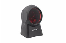
What is the function of laser scanning platform?
3d laser scanning technology, also known as real scene replication technology, is another technological revolution after GPS technology in the field of surveying and mapping. It has the characteristics of rapidness, high benefit, non-contact, penetration, high precision, digitization, automation, and strong real-time performance, which solves the neck bottle of real-time and accurate development of spatial information technology. Therefore, many businesses need to use laser scanning platform, so what role does laser scanning platform have?

Provide high-precision data
Laser scanning platform can provide scanning the surface of the object three-dimensional point cloud data, thus can be used to obtain the high accuracy of high resolution digital terrain model, through the analysis of high speed laser scanning measurement method of large area high resolution to quickly get three-dimensional coordinates on the surface of the object being measured data, a lot of space point information, the application of laser scanning platform to make the engineering data in many industries.
Second, obtain spatial data
With the development and maturity of 3d scanning technology, it quickly becomes an important technical means of spatial data acquisition, and causes the upsurge of technical change in many industries. The essential application of 3d laser scanner in engineering construction is the acquisition of field data. Different from the traditional point measurement, it is the big data of construction engineering. Any measurement, actual measured quantity and construction node comparison are all based on this big data.
Provide real planning information
3 d laser scanning technology at the beginning of the project construction plan can provide engineering construction site perfect 1:1 true color 3 d point cloud model, including topography, traffic lines, the surrounding buildings, emergency channel and ventilation facilities, compare the basis of uav aerial can obtain more comprehensive information, provides the accurate basis for the planning and design, laser scanning platform can offer real data basis for later operations.
If the field data with the conventional means of surveying and mapping measurement will be a barely task, in this case the use of 3 d laser scanning technology to obtain actual three-dimensional point cloud data, provides reliable data for the design to solve this problem well, choose cost-effective laser scanning platform or quality assured laser scanning platform is very important.

This is a sample comment...